Here you can see some of our work, vertical and oblique photography for very high resolution orthophoto (up to 2 cm georeferenced photographic maps) and 3D digital models that allow the identification of very small objects using computational techniques such as Artificial Intelligence (AI). Some projects have a VR link version inside the visualization apps.
For VR beginners please follow these instructions:
3D MODELS
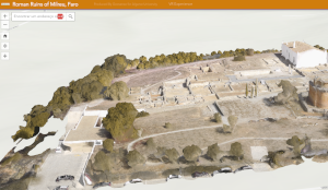
Roman ruins of Milreu, Faro
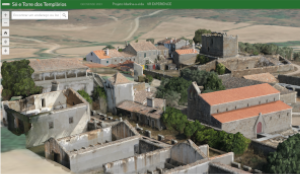
Idanha-a-Vida project in Idanha-a-Velha
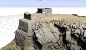
Geological formations next to Forte das Velas (Guincho) 360 VR
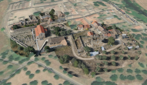
Idanha-a-Vida project in Idanha-a-Velha 360 VR
CONTACT US
We are here to help answer your questions, our experts are on hand to advise on all aspects of our service.
Do not hesitate to contact us.