At Geosense, we turn visions into reality by delivering innovative geospatial solutions.
Browse our diverse portfolio to discover our services and projects.
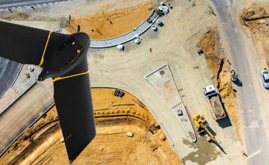
Aerial Photogrammetry
The aerial photography is the taking of aerial images for the preparation of maps. The Geosense has professional equipment to carry out this type of work, including a fixed wing Drone, the Ebee, able to cover areas up to 10 km2 in a single flight, or perform aerial images with 3 cm resolution.
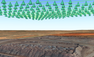
3D Modeling
Vertical and oblique photographic images for creating orthophotos (georeferenced photographic maps) and very high resolution 3D digital terrain models (up to 2 cm) that allow the identification of very small objects.
CONTACT US
We are here to help answer your questions, our experts are on hand to advise on all aspects of our service.
Do not hesitate to contact us.